Category:Maps
Maps used in the National Atlas of Spain
Media in category "Maps"
The following 200 files are in this category, out of 321 total.
(previous page) (next page) Barcelona Synthetic-vulnerability-index.-City-of-Barcelona 2017 map 18011 eng.jpg 1,388 × 1,016; 169 KB
 China Origins-and-spread-of-Covid--19-in-China 2020 map 17842 eng.jpg 933 × 685; 123 KB
 Europe COVID--19-cases-in-the-European-Union 2020 map 17792 eng.jpg 1,388 × 1,016; 199 KB
 Europe Deaths-from-COVID--19-in-the-European-Union 2020 map 17793 eng.jpg 1,388 × 1,016; 176 KB
 Europe Employment-rate-in-the-European-Union 2020 map 18103 eng.jpg 933 × 898; 117 KB
 Europe Gross-Domestic-Product-in-the-European-Union 2019-2020 map 18086 eng.jpg 1,388 × 1,016; 175 KB
 Europe Healthcare-workers-in-the-European-Union 2018 map 17875 eng.jpg 1,388 × 1,016; 187 KB
 Europe Main-airports-in-the-European-Union 2019 map 17850 eng.jpg 933 × 1,016; 205 KB
 Europe Most-populous-cities-in-the-European-Union 2019 map 18141 eng.jpg 933 × 1,016; 208 KB
 Europe Population-density-in-the-European-Union 2019 map 18193 eng.jpg 933 × 1,016; 182 KB
 Europe Unemployment-rate-in-the-European-Union 2020 map 18102 eng.jpg 933 × 898; 125 KB
 Galicia COVID--19-Cases-in-Galicia 2020 map 17884 eng.jpg 933 × 685; 128 KB
 Galicia COVID--19-hotspots-in-Galicia 2020 map 17885 eng.jpg 933 × 685; 106 KB
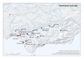 Iberian-Peninsula--south Tartessian-culture 2014 map 16028 eng.jpg 797 × 567; 123 KB
 L 40 horas sol.jpg 1,824 × 1,252; 1.99 MB
 L 87 nucleos comerciales.jpg 3,852 × 2,708; 1.58 MB
 Lluvia media anual.jpg 3,194 × 2,130; 2.52 MB
 Madrid COVID--19-cases-in-the-city-of-Madrid 2020 map 17919 eng.jpg 709 × 756; 92 KB
 Madrid COVID--19-cases-in-the-Region-of-Madrid 2020 map 17918 eng.jpg 933 × 685; 131 KB
 Madrid Social-benefits-in-the-city-of-Madrid 2018 map 17773 eng.jpg 709 × 756; 74 KB
 Madrid Solidarity-initiatives-during-the-pandemic.-Madrid 2020 map 18464 eng.jpg 1,388 × 1,016; 255 KB
 Madrid Synthetic-vulnerability-index.-City-of-Madrid 2017 map 18012 eng.jpg 1,388 × 1,016; 179 KB
 Madrid Unemployed-in-the-city-of-Madrid 2020 map 17774 eng.jpg 709 × 756; 81 KB
 Malaga Covid--19-hotspots 2020 map 17727 eng.jpg 874 × 618; 185 KB
 Malaga Population-density-and-Covid--19-hotspots 2020 map 17733 eng.jpg 874 × 618; 152 KB
 Malaga Risk-of-Covid--19-transmission 2020 map 17738 eng.jpg 874 × 618; 123 KB
 Malaga Vulnerability-to-Covid--19 2020 map 17737 eng.jpg 874 × 618; 121 KB
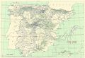
 Mapa españa 1M500.jpg 6,958 × 5,190; 6.64 MB
 Saragossa COVID--19-frequentation-rate.-City-of-Zaragoza 2020 map 18151 eng.jpg 1,330 × 958; 207 KB
 Spain Air-passenger-traffic 2019-2020 map 18177 eng.jpg 933 × 685; 138 KB
 Spain Air-traffic 2019-2020 map 18201 eng.jpg 933 × 685; 137 KB
 Spain Average-February-temperature 1981-2010 map 18405 eng.jpg 709 × 525; 97 KB
 Spain Average-February-temperature 2020 map 18393 eng.jpg 709 × 525; 97 KB
 Spain Average-Solar-Insolation-in-March 1981-2010 map 18404 eng.jpg 709 × 525; 78 KB
 Spain Average-Solar-Insolation-in-March 2020 map 18394 eng.jpg 709 × 525; 79 KB
 Spain Beneficiaries-of-unemployment-benefits 2019-2020 map 17873 eng.jpg 933 × 685; 119 KB
 Spain Bourbon-administrative-and-territorial-organization 1700-1799 map 14003 eng.jpg 1,388 × 1,016; 342 KB
 Spain Commercial-vessel-traffic 2019-2020 map 17694 eng.jpg 933 × 685; 114 KB
 Spain Communities-and-germanias 1520-1522 map 16784 eng.jpg 933 × 685; 187 KB
 Spain Companies-deemed-as-being-essential 2019 map 17790 eng.jpg 1,388 × 1,016; 226 KB
 Spain Companies-using-furlough-schemes 2020 map 17874 eng.jpg 933 × 685; 138 KB
 Spain Coverage-of-unemployment-benefits 2019-2020 map 17871 eng.jpg 933 × 685; 122 KB
 Spain Crisis-of-1640 1631-1668 map 16790 eng.jpg 933 × 685; 215 KB
 Spain Cruise-ship-passengers 2019-2020 map 17700 eng.jpg 933 × 685; 102 KB
 Spain Deaths.-April-2020 2020 map 18171 eng.jpg 709 × 526; 82 KB
 Spain Deaths.-Average-April-2017--2019 2017-2019 map 18167 eng.jpg 709 × 526; 80 KB
 Spain Deaths.-Average-June-2017--2019 2017-2019 map 18169 eng.jpg 709 × 526; 80 KB
 Spain Deaths.-Average-March--June-2017--2019 2017-2019 map 18162 eng.jpg 933 × 685; 112 KB
 Spain Deaths.-Average-March-2017--2019 2017-2019 map 18166 eng.jpg 709 × 526; 81 KB
 Spain Deaths.-Average-May-2017--2019 2017-2019 map 18168 eng.jpg 709 × 526; 80 KB
 Spain Deaths.-June-2020 2020 map 18173 eng.jpg 709 × 526; 78 KB
 Spain Deaths.-March--June-2020 2020 map 18163 eng.jpg 933 × 685; 112 KB
 Spain Deaths.-March-2020 2020 map 18170 eng.jpg 709 × 526; 82 KB
 Spain Deaths.-May-2020 2020 map 18172 eng.jpg 709 × 526; 79 KB
 Spain Density-of-human-settlements 2020 map 18025 eng.jpg 1,388 × 1,016; 233 KB
 Spain Downscaling-process.-Fifth-week 2020 map 17759 eng.jpg 709 × 525; 76 KB
 Spain Downscaling-process.-First-week 2020 map 17755 eng.jpg 709 × 525; 70 KB
 Spain Downscaling-process.-Fourth-week 2020 map 17758 eng.jpg 709 × 525; 76 KB
 Spain Downscaling-Process.-Second-week 2020 map 17756 eng.jpg 709 × 525; 81 KB
 Spain Downscaling-process.-Seventh-week-(I) 2020 map 17761 eng.jpg 709 × 525; 75 KB
 Spain Downscaling-process.-Sixth-week 2020 map 17760 eng.jpg 709 × 525; 73 KB
 Spain Downscaling-Process.-Third-week 2020 map 17757 eng.jpg 709 × 525; 81 KB
 Spain E--commerce-during-the-pandemic 2019-2020 map 18533 eng.jpg 709 × 526; 84 KB
 Spain Early-Iron-Age 2014 map 13977 eng.jpg 1,418 × 2,008; 772 KB
 Spain Emigration-in-the-19th-century 1887 map 15702 eng.jpg 709 × 526; 99 KB
 Spain Employed-during-the-first-wave-of-the-pandemic 2019-2020 map 17784 eng.jpg 1,388 × 1,016; 200 KB
 Spain Estimated-unemployment-by-sex 2019 map 17845 eng.jpg 709 × 526; 84 KB
 Spain Estimated-youth-unemployment 2019 map 17847 eng.jpg 709 × 526; 87 KB
 Spain Evolution-in-natural-gas-consumption 2019-2020 map 18581 eng.jpg 933 × 685; 100 KB
 Spain Expulsion-of-the-Moors 1546-1647 map 14001 eng.jpg 933 × 685; 229 KB
 Spain First-COVID--19-cases 2020 map 17956 eng.jpg 933 × 685; 118 KB
 Spain First-deaths-from-COVID--19-deaths 2020 map 17958 eng.jpg 933 × 685; 98 KB
 Spain First-hospital-admissions-due-to-COVID--19 2020 map 17957 eng.jpg 933 × 685; 116 KB
 Spain Furloughed-workers 2020 map 17849 eng.jpg 933 × 685; 121 KB
 Spain Healthy-life-years 2007-2018 map 18147 eng.jpg 933 × 685; 100 KB
 Spain Home-office-during-the-pandemic 2020 map 18158 eng.jpg 709 × 526; 80 KB


_0100-0400_map_16774_eng.jpg)


_1086-1147_map_13996_eng.jpg)
_1147-1232_map_13997_eng.jpg)


_2020_map_17761_eng.jpg)
-End-of-the-state-of-alarm_2020_map_17762_eng.jpg)


_1766-1767_map_15786_eng.jpg)


