Difference between revisions of "Talk:Main Page"
| Line 9: | Line 9: | ||
| − | {| cellspacing="0" cellpadding="0" style="margin-top: 0; margin-right: 0; margin-bottom: 1em; margin-left: 2px; float:left; margin-right: 0px; width: | + | {| cellspacing="0" cellpadding="0" style="margin-top: 0; margin-right: 0; margin-bottom: 1em; margin-left: 2px; float:left; margin-right: 0px; width: 100%" |
| style="vertical-align: top; border-style: solid; border-top-right-radius: 10px; border-top-left-radius: 10px;border-bottom-right-radius: 10px; border-bottom-left-radius: 10px; border-width: 1px; border-color: #446291; background-color: #f6fbfd" | | | style="vertical-align: top; border-style: solid; border-top-right-radius: 10px; border-top-left-radius: 10px;border-bottom-right-radius: 10px; border-bottom-left-radius: 10px; border-width: 1px; border-color: #446291; background-color: #f6fbfd" | | ||
| Line 37: | Line 37: | ||
|} | |} | ||
| − | {| cellspacing="0" cellpadding="0" style="margin-top: 0; margin-right: 0; margin-bottom: 1em; margin-left: 2px; float:left; margin-right: 0px; width: | + | {| cellspacing="0" cellpadding="0" style="margin-top: 0; margin-right: 0; margin-bottom: 1em; margin-left: 2px; float:left; margin-right: 0px; width: 49%" |
| style="vertical-align: top; border-style: solid; border-top-right-radius: 10px; border-top-left-radius: 10px;border-bottom-right-radius: 10px; border-bottom-left-radius: 10px; border-width: 1px; border-color: #9bb0d1; background-color:#f6fbfd" | | | style="vertical-align: top; border-style: solid; border-top-right-radius: 10px; border-top-left-radius: 10px;border-bottom-right-radius: 10px; border-bottom-left-radius: 10px; border-width: 1px; border-color: #9bb0d1; background-color:#f6fbfd" | | ||
| Line 54: | Line 54: | ||
|} | |} | ||
| − | {| cellspacing="0" cellpadding="0" style="margin-top: 0; margin-right: 0; margin-bottom: 1em; margin-left: 2px; float:right; margin-right: 0px; width: | + | {| cellspacing="0" cellpadding="0" style="margin-top: 0; margin-right: 0; margin-bottom: 1em; margin-left: 2px; float:right; margin-right: 0px; width: 49%" |
| style="vertical-align: top; border-style: solid; border-top-right-radius: 10px; border-top-left-radius: 10px;border-bottom-right-radius: 10px; border-bottom-left-radius: 10px; border-width: 1px; border-color: #67809f; background-color:#f6fbfd" | | | style="vertical-align: top; border-style: solid; border-top-right-radius: 10px; border-top-left-radius: 10px;border-bottom-right-radius: 10px; border-bottom-left-radius: 10px; border-width: 1px; border-color: #67809f; background-color:#f6fbfd" | | ||
Revision as of 15:12, 8 June 2022

|
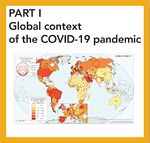
The COVID-19 pandemic in Spain. First wave: from the first cases to the end of June 2020
New publication
Individual contents
|
|
Visualizadores
|
|
Ediciones anteriores del ANE y antecedentes
Un Atlas Nacional es un atlas geográfico fundamental y complejo que contiene una recapitulación y una generalización de los conocimientos científicos contemporáneos en el campo de la geografía física, económica, cultural y política del país considerado. Sirve como herramienta de consulta al añadir un valor esencial para el gestor público, y al proporcionar el conocimiento de los diferentes aspectos que caracterizan el territorio en las actividades empresariales; a su vez, constituye un punto de referencia educativo para la población en general... |