Difference between revisions of "Talk:Main Page"
| Line 1: | Line 1: | ||
| − | {| cellspacing="0" style="margin-top: 0; margin-bottom: | + | {| cellspacing="0" style="margin-top: 0; margin-bottom: 2em; float:right; width: 100%" |
| style="vertical-align: center; border-style: solid; border-width: 0.5px; border-color: #13417D; background-color:#a8bfe2" | | | style="vertical-align: center; border-style: solid; border-width: 0.5px; border-color: #13417D; background-color:#a8bfe2" | | ||
<div style="background:#a8bfe2; text-align: center; overflow: hidden; position: relative;"> | <div style="background:#a8bfe2; text-align: center; overflow: hidden; position: relative;"> | ||
Revision as of 16:07, 8 June 2022

|
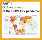
The COVID-19 pandemic in Spain. First wave: from the first cases to the end of June 2020
Individual contents
|
|
Map viewers
|


|
Background
A National Atlas is a fundamental and complex geographical atlas containing a synthesis of contemporary scientific knowledge in the field of physical, economic, cultural and political geography of the country under consideration. It serves as a reference tool by adding essential value for the public manager, and by providing knowledge of the different aspects that define the territory in business activities; at the same time, it provides an educational reference point for the wider population... |