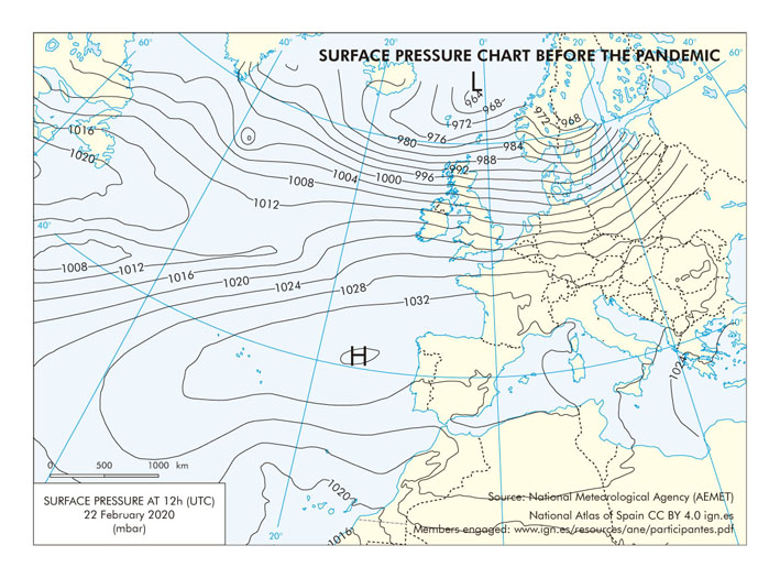
File:North-Atlantic Surface-pressure-chart-before-the-pandemic 2020 map 18385 eng.jpg
No higher resolution available.
North-Atlantic_Surface-pressure-chart-before-the-pandemic_2020_map_18385_eng.jpg (709 × 525 pixels, file size: 129 KB, MIME type: image/jpeg)
Summary
Resource used for the creation of the National Atlas of Spain.
Access the CNIG Download Centre to download its files in higher resolution:
PDF JPG More information
Licensing
CC BY 4.0 ign.es, 2021
See the list of members engaged
File history
Click on a date/time to view the file as it appeared at that time.
| Date/Time | Thumbnail | Dimensions | User | Comment | |
|---|---|---|---|---|---|
| current | 08:14, 31 May 2022 | | 709 × 525 (129 KB) | Usr18 (talk | contribs) | User created page with UploadWizard |
- You cannot overwrite this file.
File usage
The following 3 pages link to this file: